 |
Abernathy/McBee
Mica Mine
Mitchell County, North Carolina Last Updated: May 14th, 2023 |
 |
My first trip to the Abernathy Mine was in 2006. My "go to" reference book in those days was "Rock, Gem, and Mineral Collecting Sites in Western North Carolina" authored by Richard James Jacquot, Jr. On page 52, Rick provided the directions to the Abernathy Mine that I have reproduced here:
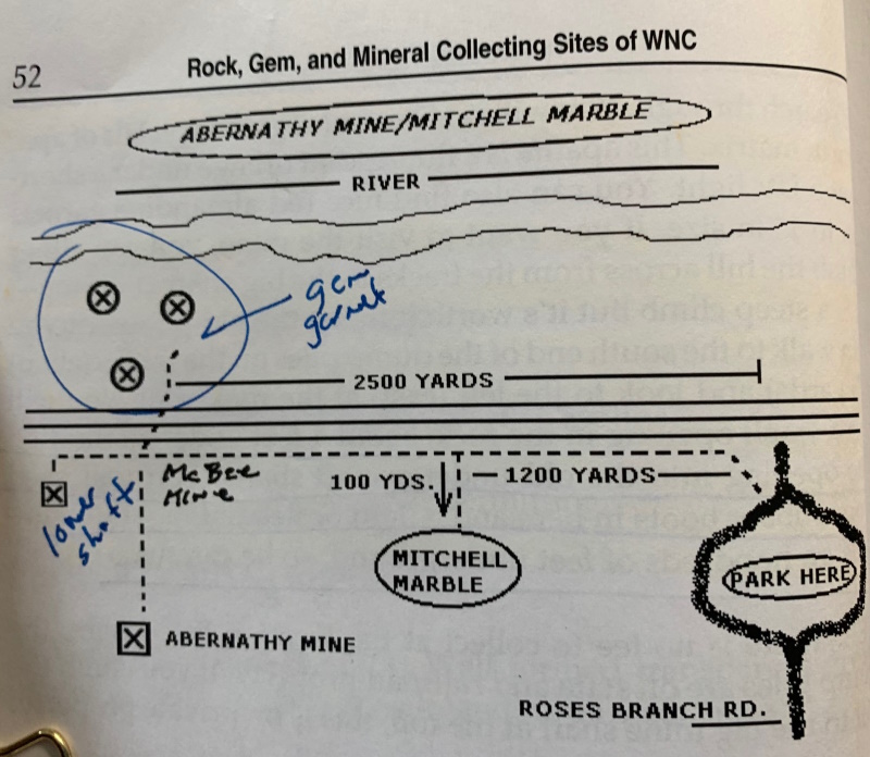 |
| The quickest way to get
to Roses Branch Road is to take Rt 19E to Rt
226N (past the large Pine Mountain Quarry on the
right) and go north toward Bakersville. Before
Bakersville, turn left at the Sink Hole Mine
sign. Continue until you turn left (south) on Rt
80N. Roses Branch Rd will be about 1.5 miles on
your right. The coordinates of the parking area
are 35 59.457 N, 082 11.448 W. |
 |
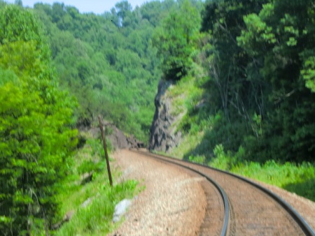
Walk up the hill to the
train tracks to the left. Walk to the left about
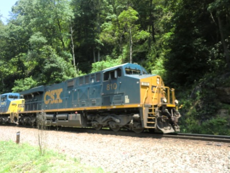
2500 yds (1.5 miles) about 20-30 minutes. Remember you will be walking back so don't plan on bringing back anything more than you can carry. Bring plenty of water and snacks. The trains run about every 20-30 minutes so walk on the outside of the tracks and be prepared to move close to the hill on your left or to the right toward the Toe River as the train passes. The hill going down to the river is steep. If you bring children, have them close to you at all times. This is not a good place to bring pets. |
The coordinates of the tailings are 35 58.226 N, 082 11.457 W
 |
 |
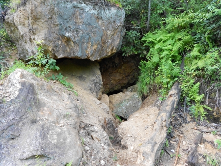
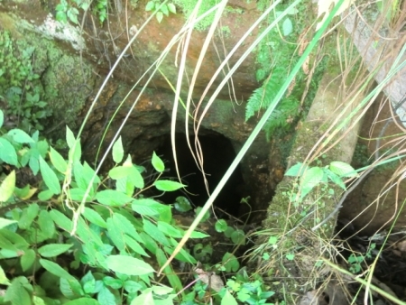
| This is the entrance of the
McBee Mica Mine directly across the tracks and
up a short climb. Enjoy the very cool breeze
coming from the entrance of the mine. But
do not attempt to enter the tunnel.
|
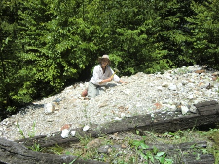
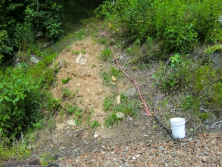
This is the collecting area
located on the Toe River side of the tracks.
It consists of the tailings from the Abernathy
Mine at the top of the hill and the McBee Mica
Mine at the bottom. |
This rocks above the
mine entrance are unstable!
Minerals which can be found in
Abernathy/McBee Mica Mine Tailings
The collecting material is classic pegmatite with very nice muscovite in the quartz and feldspar matrix.
Red Almandine Garnet crystals are commonly found in the mix. Tourmaline and green apatite (fluoresces orange under short UCV light) are found quite often. Aquamarine has been found but is less common.
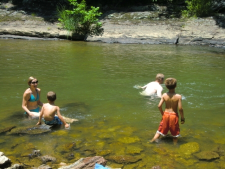
If you want to take a break from the rock hounding, why not try a swim call in the nearby Tow River?
The Return Trip
But, be sure to look out for trains from either direction on the return trip!
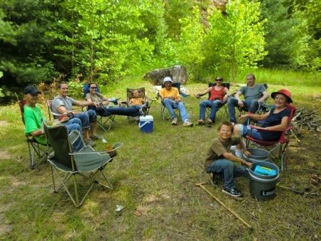
Bo's Mine Tours began using a trail head at the Mitchell Marble Mine in 2010
Bud
gave
me permission to use his Marble Mine as a trail head for
Abernathy/McBee tours and for camping for camping t his
marble mine. My Bo's MIne Tours assistant, Chris
Wyatt and I went to work and created a very nice camp site
at the marble mine. The collecting material is classic pegmatite with very nice muscovite in the quartz and feldspar matrix.
Red Almandine Garnet crystals are commonly found in the mix. Tourmaline and green apatite (fluoresces orange under short UCV light) are found quite often. Aquamarine has been found but is less common.
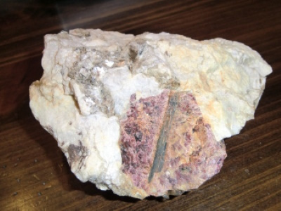 |
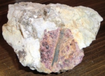
I found this spectacular sample of a large Almandine Garnet crystal (about 11/2 inches) with a green tourmaline crystal inclusion on my first trip to the Abernathy/McBee tailings in June 2006. Perhaps you will have similar luck! |
If you want to take a break from the rock hounding, why not try a swim call in the nearby Tow River?
 |
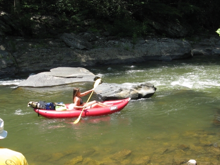 |
| Family enjoying a swim call in the quiet area above the McBee rapids to their right. | You
might even see some kayakers or tubers taking
on the mild rapids. |
The Return Trip
 |
 |
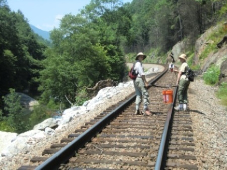
| These
ladies have figured out a great way to haul
their 5 gal barrel back to the parking lot. |
You're
almost there. When you see the "Looking Glass"
rock ahead on the right you have about 1/2 mile
to go. |
But, be sure to look out for trains from either direction on the return trip!
Bo's Mine Tours began using a trail head at the Mitchell Marble Mine in 2010
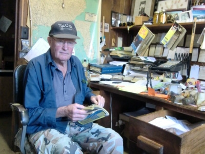 Bud Phillips was the owner of the Mitchell Lumber Company in Spruce Pine. Bud was a large land owner and forester who had numerous mines on his properties. He took an interest in me and was helpful in introducing me to numerous mine owners and other useful contacts. |
I met Bud Phillips after my first trip to the Abernathy Mine in 2005. After some discussion, he not only gave me his permission to use his Marble Mine access to the Toe River tracks to the Abernathy Mine, but he also gave me a key to the gate blocking the road access to the mine. Bud also told me the story about how the Abernathy Mine was the top portion of the vertical shaft with access from Abernathy Road off Rt 80N just south of Bandana, but also that he owned the McBee Mine access at the bottom of the vertical shaft at the Toe River level. He had worked the McBee Mine himself in the 1960s so had a great deal of helpful information about the McBee Mine. |
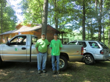 Bo Smith and Chris Wyatt of Bo's
Mine Tours
|
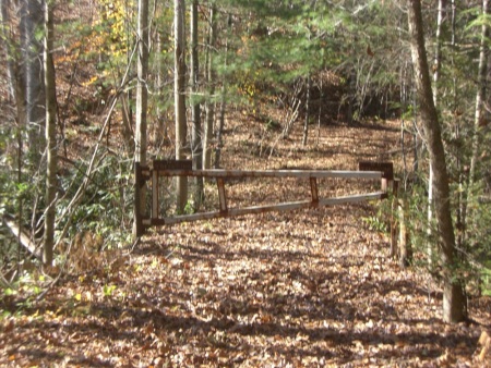
The tour required a 4WD/AWD vehicle to traverse the Marble Mine Road to the Marble Mine parking area. Non 4WD/AWD vehicles were left at the Marble Mine gate. Bo's Mine Tours provided a 4WD truck to transport tour participants and their supplies.
 Gate to Bud's Marble Mine
|
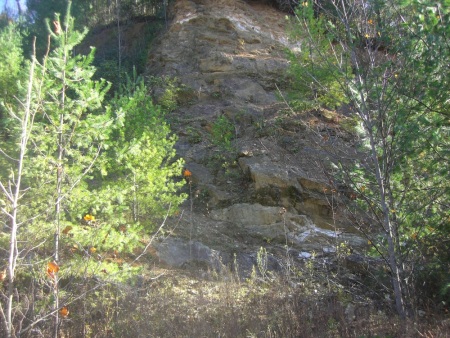 Marble Mine Cliff Face
|
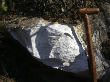 The marble is a fine
white which polishes beautifully
|
 The Marble Mine had a nice
grassy area near the N.Toe River.
It provided a great spot for resting or camping. |
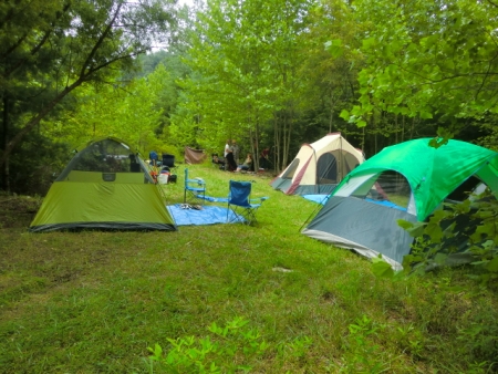 We had enough grassy area
for three tents.
|
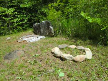 We had a cooking fire made of slate, a fire pit, and a latrine. |
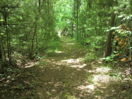
Road
from Marble Mine camping area to river tracks
|
 Access to the railroad tracks from
the Marble Mine
|
Before leaving the Marble Mine, I conducted a brief
discussion of the history of the McBee and Abernathy Mica
Mines and discussed the minerals which could be found in
the collection area. It is about an .8 mile hike
from the Marble Mine along the train track to the McBee
Mine entrance, collecting area, and swimming spot at the
McBee rapids. Loaded coal trains from West Virginia
pass north to south through the area about every hour and
empty trains (100 cars+) also pass south to north. The
trains continue to run throughout the night for your
enjoyment for the overnight campers.
My wife Diana's son Dr. Hampton Groover visited with his family and they stayed at the Marble Mine campground for a couple of days and worked on the tunnel entrance.
Before and after the tunnel entrance work!
Although I didn't know Malachi all that well, our exploration of the mine was a significant event for both of us. I had received a detailed account about what to expect from Bud Phillips. I lead the exploration and had a rope around my waist so that Malachi could save me if I fell into a shaft we didn't expect.
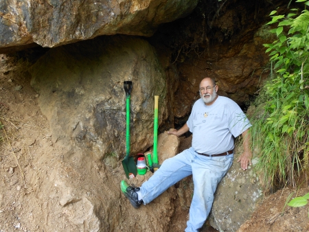
The McBee Mine Entrance Tunnel
The McBee Mine
Entrance Tunnel Work During the Summer 2011 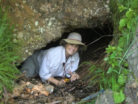 |
This is what the McBee Mine entrance looked like when I began giving Bo's Mine Tours in 2010. This lady was the first tour goer who was adventurous enough to work her way into the mine entrance. She discovered about 18 inches of very cold water but could see some entrance lumber in the tunnel. I asked Bud Phillips about it in 2011 and he gave me permission to try to clear the tunnel entrance! |
My wife Diana's son Dr. Hampton Groover visited with his family and they stayed at the Marble Mine campground for a couple of days and worked on the tunnel entrance.
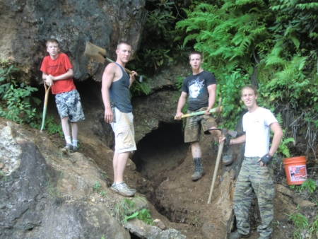 Four of my "grandsons" removed
several large and small rocks (mine muck) and
about 200 5gal buckets of soil from the tunnel
entrance. Thanks guys!
|
 Quite a bit of very cold water
flowed out the tunnel entrance after the rock,
soil, and muck were removed.
|
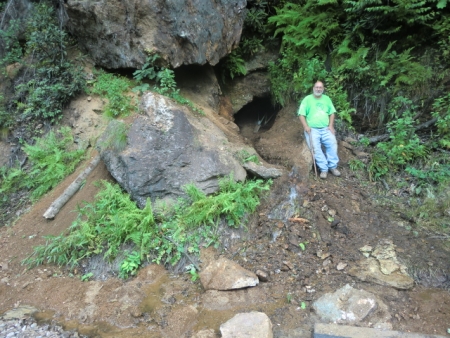
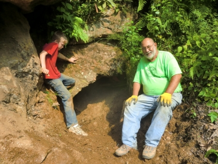 Mine entrance after completion of
the recent work on July 22nd. There is a cool
breeze (57 deg. F) blowing from the tunnel.
|
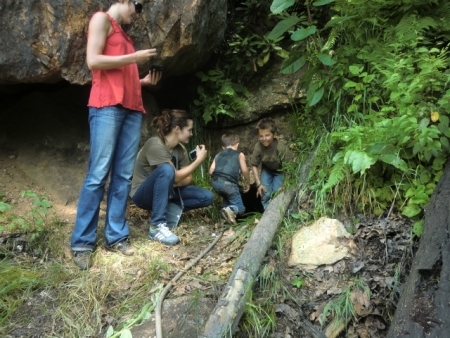 After the work was done, the smaller kids took a look at the tunnel. But, noone was brave enough to enter the tunnel. Except Malachi, second from the left. He was up for it! |
Before and after the tunnel entrance work!
Although I didn't know Malachi all that well, our exploration of the mine was a significant event for both of us. I had received a detailed account about what to expect from Bud Phillips. I lead the exploration and had a rope around my waist so that Malachi could save me if I fell into a shaft we didn't expect.
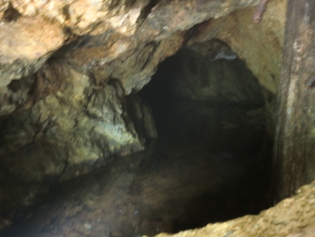 This picture shows about 12" to 18" of cold
water which existed at the front of the
tunnel before the mine work of July 22nd. The
tunnel becomes dry about 30 feet inside the
tunnel. The air inside the tunnel is 57 degrees F.
The wood timber on the right is part of an old
gate which was used to restrict access during the
period when the mine was in operation.
|
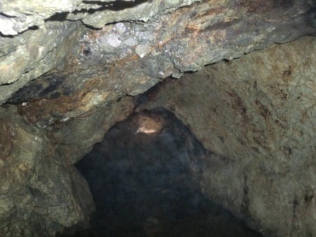
 This picture of the water level after the work on the tunnel entrance on July 22nd. You can see the old water and current water level. About a foot of water has drained from the tunnel as a result of our work on July 21st and 22nd. The water at the front of the tunnel is now about 8" to 10". |
 After a few feet of water at the entrance, the tunnel is dry and leads to a large room that contains wood winches toi alower level of the mine which is full of water. Unfortunaely, I didn't get a picture of this room. |
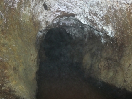 After about 30 feet or so. there is a tunnel which goes to the right. The tunnel gives off a silvery glow when illuminated with a head lamp.This tunnel connects escape location which is by the tracks from the mine entrance. |
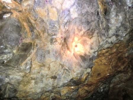 We were able to see a few garnets in the ceiling oif the tunnel but we not interested in collecting them. We were more interested in exploring the tunnel. |
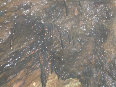 There were numerous black stalactites from the ceiling. I suspect that the black color was due to iron staining from the ground water.We were |
The large room which contains a shaft and the remains of a hoist system which was used to raise material from a tunnel system below when the mine was dry. . Bud Phillips estimates that there is about 300,000,000 gallons of water in the lower tunnel system. There is a pile of debris beyond the hoist room which partially blocks another large room.
Tunnel photography was accomplished using non flash settings with light provided by flashlight. The camera flash results in very blurred images due to the reflection of the flash by water droplets in the high humidity environment in the tunnel.
 I am very proud of our Bo's Mine Tours work in excavating the McBee tunnel entrance, the exploration of the tunnel and our collaborative work with Bud Phillips. |
 This is the entrance to the escape tunnel. We did not try to explore it. If you want to know more about it, I suggest you get acopy of Rick Jaquot's book "Rock, Gem, and Mineral Collecting Sites in Western North Carolina". |
Tunnel
Entrance Collapse in 2013
|
Unfortunately, the tunnel entrance experienced a collapse sometime after our work. Large rocks blocked the entrance and the large cap rock above and to the left of the entrance is unstable making any attempt to enter the tunnel dangerous. We attempted to get CSX to clear the tunnel entrance and stabalize the hillside as a safety issue for passing trains but we were unsuccessful. |
Photography
and website by Robert S. "Bo" Smith